
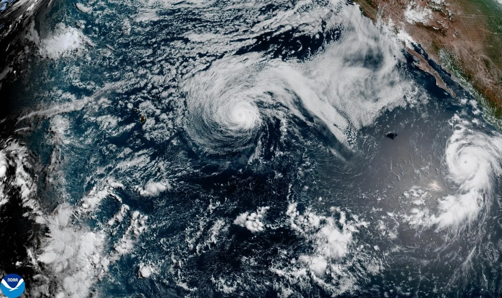
MIAMI (AP) — Rough surf was possible for Hawaii and Mexico on Tuesday thanks to two tropical cyclones in the Pacific Ocean that forecasters said were sending strong waves to some coastal areas.
Read more Wisconsin voters begin casting ballots at the polls in chaotic Democratic governor’s race
Tropical Storm Fausto was expected to pass just north of the Hawaiian islands starting Tuesday night, according to the National Hurricane Center in Miami. Fausto had maximum sustained winds of 60 mph and was expected to retain tropical storm strength as it skirted above the island chain.
On Tuesday morning, Fausto was 400 miles east of Honolulu and moving west at 14 mph. Forecaster said strong currents from the tropical storm could create dangerous conditions on some Hawaii beaches.
Meanwhile, Hurricane Genevieve was slowly weakening, the hurricane center said. It was previously a Category 5 system but by Tuesday morning it was down to a Category 3. Maximum sustained winds were 125 mph for the major hurricane, which was about 530 miles southwest of the southern tip of the Baja California peninsula.
Read more ‘No matter what you do, you can’t put it out’: Spanish firefighters describe record blaze
Swells from Genevieve were reaching Baja California and coastal southwestern Mexico. Forecasters warned of life-threatening surf and rip current conditions.
On the forecast track, Genevieve was expected to continue weakening and remain far from land. Fausto was expected to continue over the open sea and downgrade to a tropical depression on Thursday.
Read more NATO member Romania shoots down stray drones from Russia-Ukraine war after years of incursions