
The Southern California coast was spared the big damage from Hurricane Polo many worried about, as the tropical system stayed to the south and was heading toward the middle of Baja.
Read more Man ordered released on bail after decades on Utah’s death row after DNA tests show no match to him
While surf was elevated from the tropical storm into Monday, especially in northern Orange County, and a high tide of about 6 feet in the morning hours posed even more threat, the coast seemed to be spared the big damage Hurricane Marie wreaked earlier in the month.
“I think the outcome is that Polo is a no-show,” Newport Beach surfer Bill Sharp said as he looked out at the lake-like water Monday morning. “We’ve got a dribbly, 2-foot swell suffering under a high tide … no one was injured, no houses appeared to be falling in today. So that’s a win.”
Surfline.com forecaster Kevin Wallis said the hurricane swell was still filling in through the afternoon and evening on Monday, but “has also been underwhelming,” he said.
Hurricane Polo got smaller as it moved into the region’s swell window late Friday and Saturday. On Monday, waves in the Huntington Beach and Newport areas were about 3 to 5 feet, maybe adding another foot or two by the evening, Wallis said.
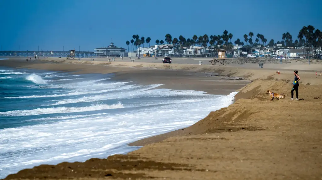 A woman stands on top of a sand berm as waves come in near Balboa Pier in Newport Beach on Monday, September 28, 2026. (Photo by Paul Bersebach, Orange County Register/SCNG)
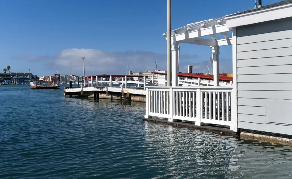 High tide comes up to the floor level at a building at the Balboa Ferry on Balboa Island in Newport Beach on Monday, September 28, 2026. (Photo by Paul Bersebach, Orange County Register/SCNG)
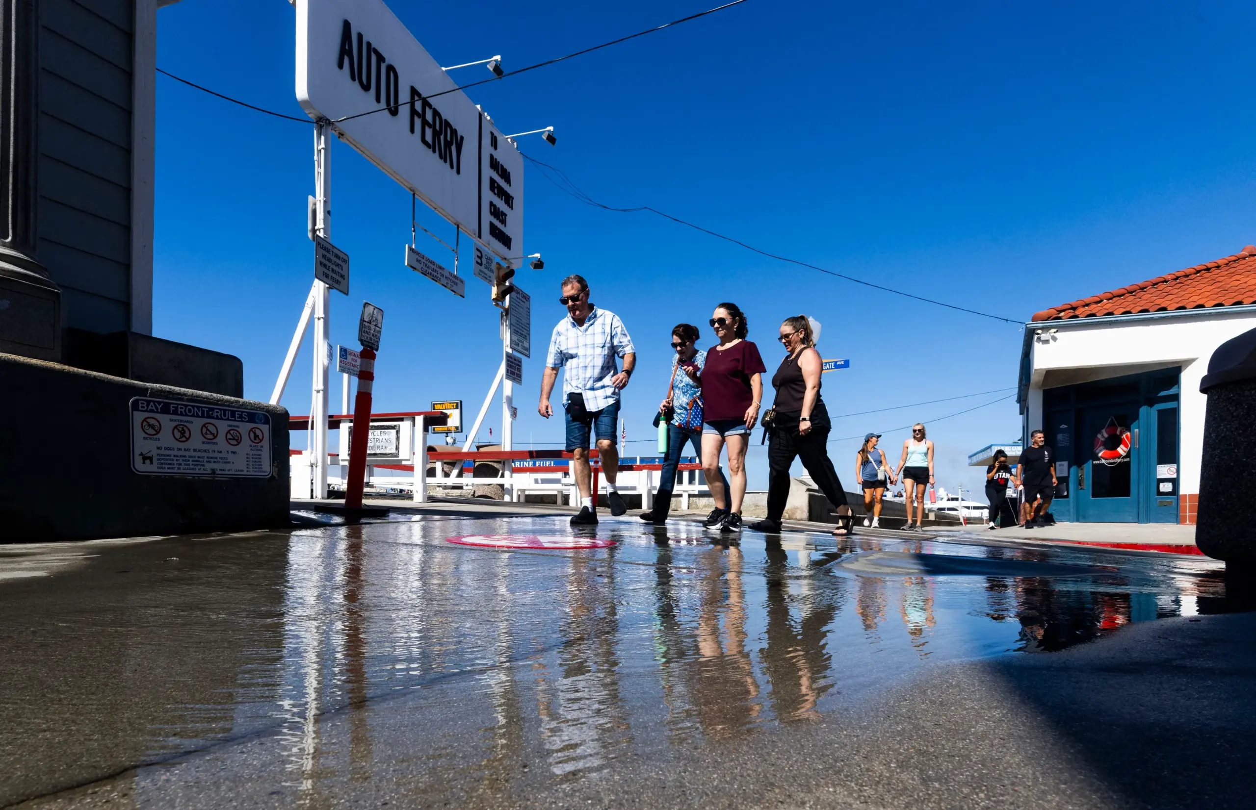
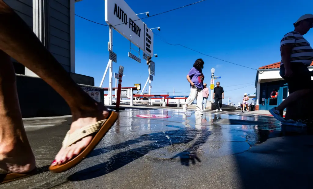 People cross a stream of water coming out of a utility box on Balboa Island in Newport Beach on Monday, September 28, 2026. (Photo by Paul Bersebach, Orange County Register/SCNG)
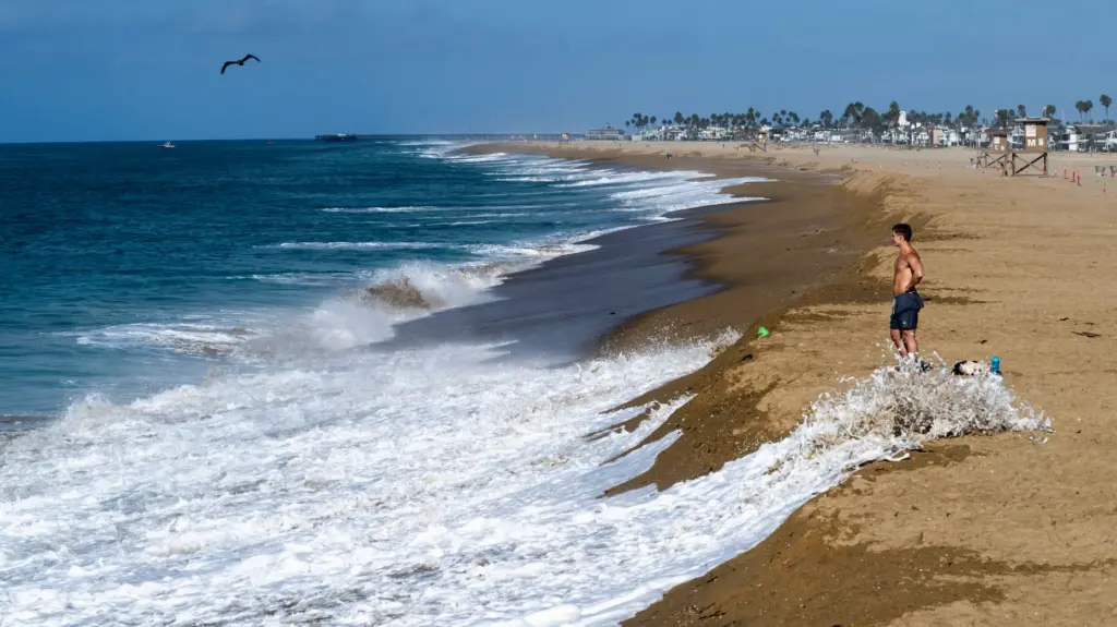 A man stands on top of a sand berm as waves come in near Balboa Pier in Newport Beach on Monday, September 28, 2026. (Photo by Paul Bersebach, Orange County Register/SCNG)
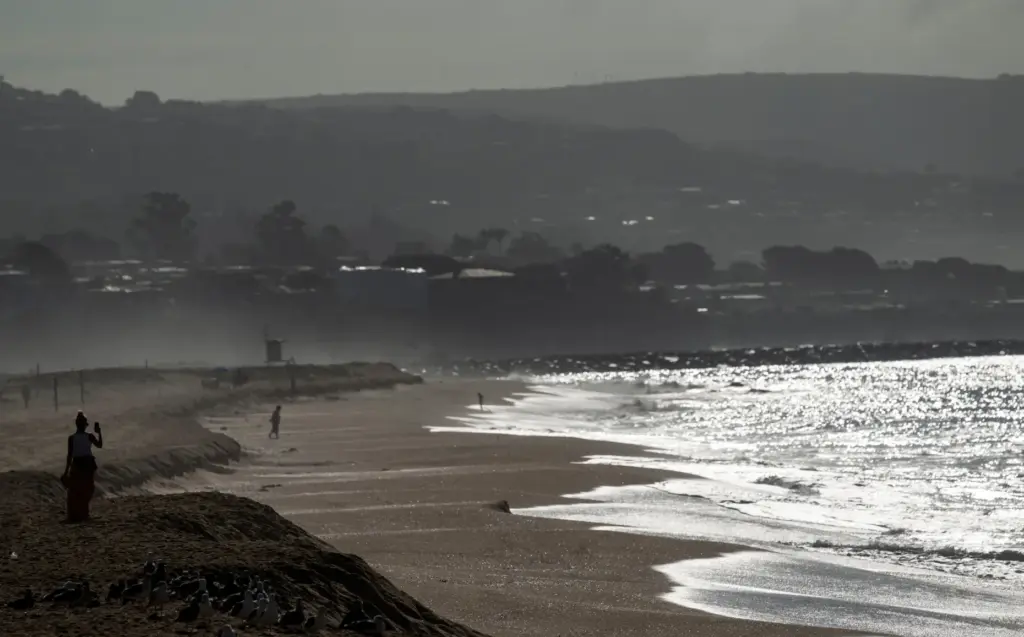 A woman takes photos from the top of a sand berm as waves come in near Balboa Pier in Newport Beach on Monday, September 28, 2026. (Photo by Paul Bersebach, Orange County Register/SCNG)
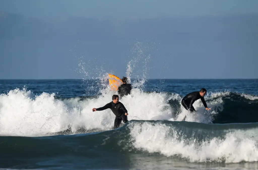 Surfers ride the waves near the Newport Pier in Newport Beach on Monday, September 28, 2026. (Photo by Paul Bersebach, Orange County Register/SCNG)
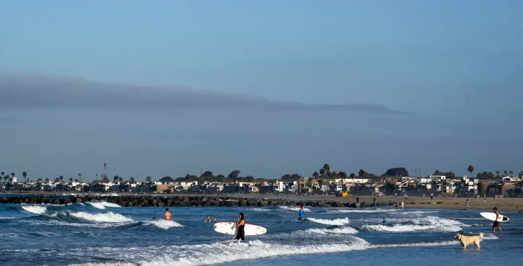 Surfers head to the waves near the Newport Pier in Newport Beach on Monday, September 28, 2026. (Photo by Paul Bersebach, Orange County Register/SCNG)
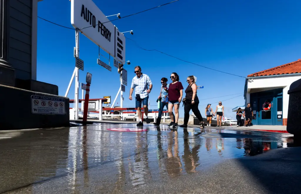 People cross a stream of water coming out of a utility box on Balboa Island in Newport Beach on Monday, September 28, 2026. (Photo by Paul Bersebach, Orange County Register/SCNG)
National Weather Service meteorologist Paul Steward said Hurricane Polo’s latest track moved to the east. “It’s going to be Arizona and New Mexico’s problem now,” he said of the rain expected to pour down in those regions due to the storm.
While the NWS had a flooding and erosion warning issued through Monday, the threat was easing by the afternoon.
“The system is moving off, so hopefully the seas will start to abate a bit,” Steward said. “It’s not much of a threat to us anymore, because of the trough helping to push the system out of the area and push Polo further to the east and keep it away from us.”
Coastal cities had been busy ahead of the hurricane, building up sand berms to keep the ocean from doing further damage — stretches of Dana Point, Laguna Beach and Newport Beach have experienced severe erosion issues from the ongoing series of tropical storms.
Read more 2 new speed cameras coming to PCH in Long Beach after Gov. Gavin Newsom signs bill
Hurricane Marie was a “direct hit” to beaches that are southerly facing, including the shoreline in front of Beach Road in Dana Point where several homes were red-tagged.
Beach Road residents were still safeguarding their homes on Monday as waves crashed onto the beachfront properties.
“We’re getting beat up, it’s bad,” said Donal Russell, general manager of the Capistrano Bay District that oversees the community. “There’s continued erosion; the contractors are stacking rocks in front of the homes as best we can. Unfortunately, they can’t do everybody’s house first, somebody has to be last. There’s people who are suffering damage.”
The California Coastal Commission has been cooperative with the efforts to safeguard the homes, Russell said, and the rock revetments that have been built up are doing a good job of absorbing the wave run-up energy, he added.
There are now only seven red-tagged homes, down from nine, with two torn down by the owners. Four yellow-tagged homes went green-tagged, Russell said. “Green doesn’t mean you’re off the hook and it’s over. It’s a temporary evaluation of the structure, and it could easily go back to yellow or red, in the near future.”
Though Hurricane Polo didn’t leave behind the damage many had feared, the worry isn’t over. Tropical Storm Rachel is churning down south and the National Hurricane Center is expecting it to turn to hurricane status by mid-week.
“I’ve heard nothing but bad news about hurricane Rachael,” Russell said. “So we’ll see in the next couple of days. … I hope they are wrong and it fizzles out into a tropical storm.”
Read more ‘Highly venomous’ non-native Gaboon viper spotted in Santa Ana neighborhood