
A big swell is set to arrive this weekend along Southern California’s west-facing beaches — should coastal communities be concerned?
Read more Voters demanded economic relief. Trump and Democrats face tough choices on how to deliver
The west, northwest swell arrives Saturday and continues into Sunday, with some Orange County beaches likely seeing sets up to 8-to-9 feet, said Sebastian Westerink, meteorologist for the National Weather Service.
Forecasts are expecting waves from 8-to-10 feet hitting at the Manhattan Beach Pier on Saturday, and 6-to-8 feet in Hermosa Beach on Saturday, according to Surfline.
While the waves are forecast to be sizable, the good news is tide levels are mid-range this week, with higher tides last week and king tides coming up at the end of the month, he said.
“We’re kind of in the middle of that period,” he said. “The tides will be relatively lower, which will keep the coastal flooding risk lower, for now.”
For Newport Beach, this weekend’s swell will be a test to see how sand berms may hold up against a winter west swells, the city’s Marine Safety Battalion Chief Mike Ure said.
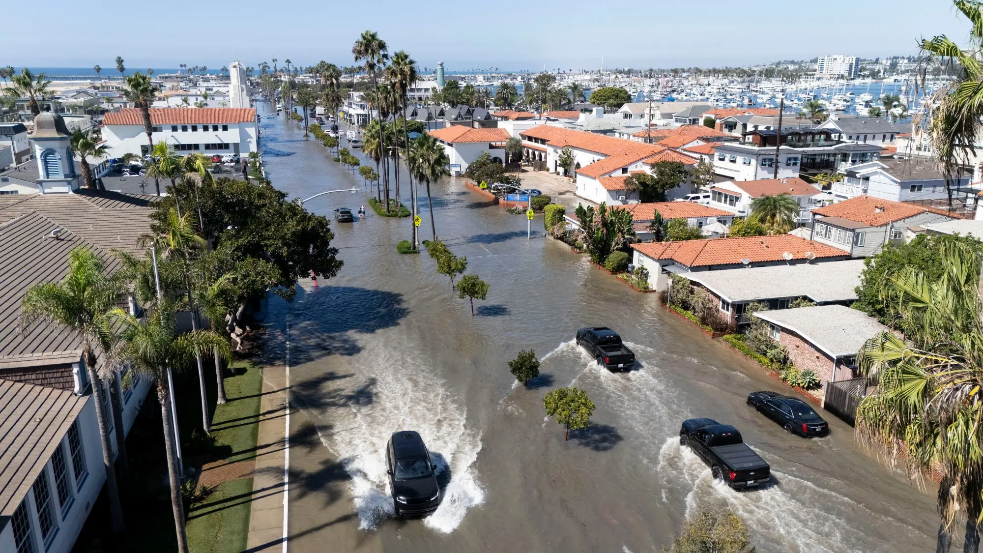
Big surf caused waves to surge across the sand and into streets, homes and businesses in early October, and the city has kept busy hauling in sand and building berms to protect against high surf and king tides expected around Thanksgiving.
Read more Russia targets emergency crews at the site of a deadly strike in southern Ukraine
The city is “optimistically cautious,” Ure said.
The swell direction for the waves this weekend tends to be more selective for Newport Beach’s coast, with longer-interval groundswells that pass much of the city’s beach, he said, unlike the south swells that hit early in October that caused severe flooding throughout the Balboa Peninsula.
There is concern about how the swell will impact erosion, but also hope that the direction of the swell will bring back some of the sand that was pushed up to Huntington Beach with the summer south swells, Ure said.
“This will be a good test, with the lower tide average, to see what larger surf will do,” Ure said. “I’m sure we will get run up on the beach, but they are bermed. We’re ready to use this as a test run.”
Warmer-than-normal water conditions from an El Nino and Kelvin waves coming up from the equator have pushed water levels up to record-breaking numbers, about 20 inches higher than usual, causing bouts of flooding recently from bays and harbors where low seawalls can’t protect against the high seawater.
But another factor may come into play with the latest storm system that is expected to drop rain on the region: Low pressure storms also cause water levels to rise more than people realize, Ure said, a factor that could add another few inches on top of the already worrisome tides.
“They call it storm surge; the storm is a low-pressure (system) that lifts the water levels more,” he said.
Read more Saudi Arabia intercepts missiles as Aramco building in Riyadh is damaged, and other Mideast news
The NWS high surf advisory is in effect from 4 p.m. Friday to 10 a.m. on Sunday.