
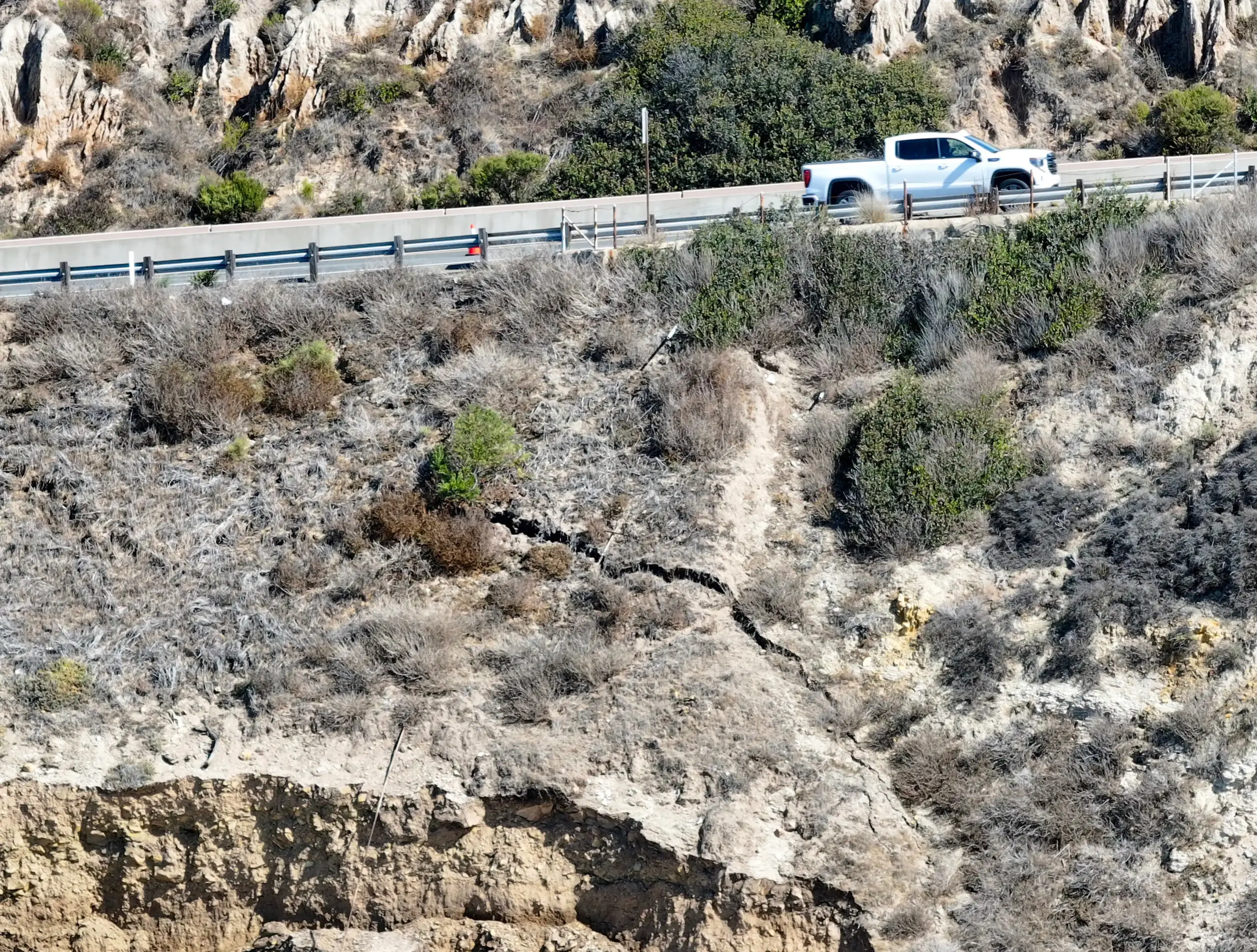
Cracks in a section of bluff adjacent to Pacific Coast Highway between Newport Beach and Laguna Beach have prompted Caltrans to assess damage, closing a lane in the southbound direction.
Read more Trump administration cuts refugees’ deadline to contest status termination, raising fears
The road near the Moro Beach area is a scenic thoroughfare through a coastal Orange County stretch that offers beach views through Crystal Cove State Park. It is also an area that was hit hard by the recent run of swells and high tides that have eroded sections of the county’s coastline.
“High tides are rapidly eroding coastal bluffs within Crystal Cove State Beach, and the slope adjacent to Pacific Coast Highway in this area appears to have been compromised,” Caltrans spokesperson Christianne Smith said.
The Orange County coastline was battered by a hurricane swell and high tides over the weekend, a combination of factors causing flooding in nearby Newport Beach on Friday, Oct. 9, and severe erosion throughout Laguna Beach and other coastal stretches. A Kelvin wave is also contributing to issues, the warm-water anomaly that travels from around the equator has pushed water levels higher for an extended period.
The cracks developing along the bluff in Crystal Cove State Park parallel to PCH were identified by Caltrans maintenance crews on Sunday, Oct. 11, Smith said.
Monday morning, Caltrans crews did a site assessment, and now its engineers are developing a plan to address the cracking, mitigate further damage and protect the roadway and traveling public, she said.
Caltrans is also coordinating with California State Parks and the California Coastal Commission to obtain the necessary permits for repairs, she noted.
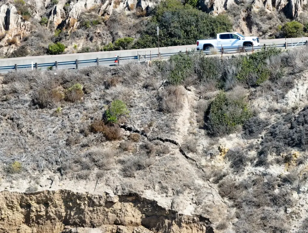 A lane of southbound traffic is shut down on Pacific Coast Highway as cracks appear in the crumbling bluff at Moro Beach at Crystal Cove State Park in Newport Beach on Tuesday, October 13, 2026. (Photo by Jeff Gritchen, Orange County Register/SCNG)
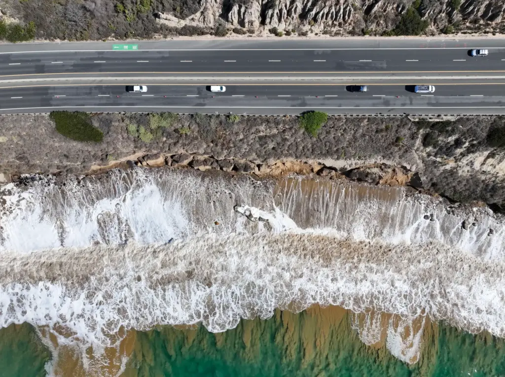 A lane of southbound traffic is shut down on Pacific Coast Highway as cracks appear in the crumbling bluff at Moro Beach at Crystal Cove State Park in Newport Beach on Tuesday, October 13, 2026. (Photo by Jeff Gritchen, Orange County Register/SCNG)
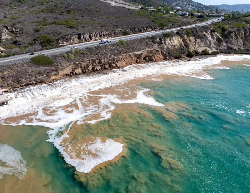 The ocean is churned up as the bluff is eroded below Pacific Coast Highway at Moro Beach at Crystal Cove State Park in Newport Beach on Tuesday, October 13, 2026. (Photo by Jeff Gritchen, Orange County Register/SCNG)
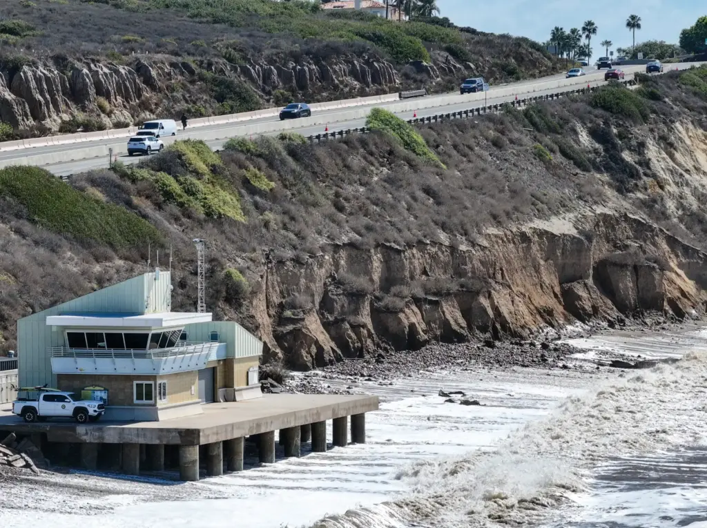 A lane of southbound traffic is shut down on Pacific Coast Highway as cracks appear in the crumbling bluff at Moro Beach at Crystal Cove State Park in Newport Beach on Tuesday, October 13, 2026. (Photo by Jeff Gritchen, Orange County Register/SCNG)
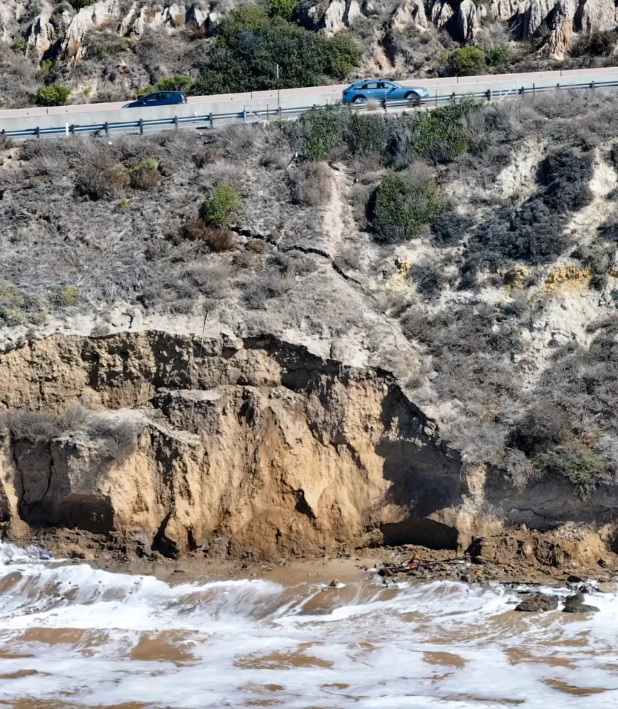 A lane of southbound traffic is shut down on Pacific Coast Highway as cracks appear in the crumbling bluff at Moro Beach at Crystal Cove State Park in Newport Beach on Tuesday, October 13, 2026. (Photo by Jeff Gritchen, Orange County Register/SCNG)
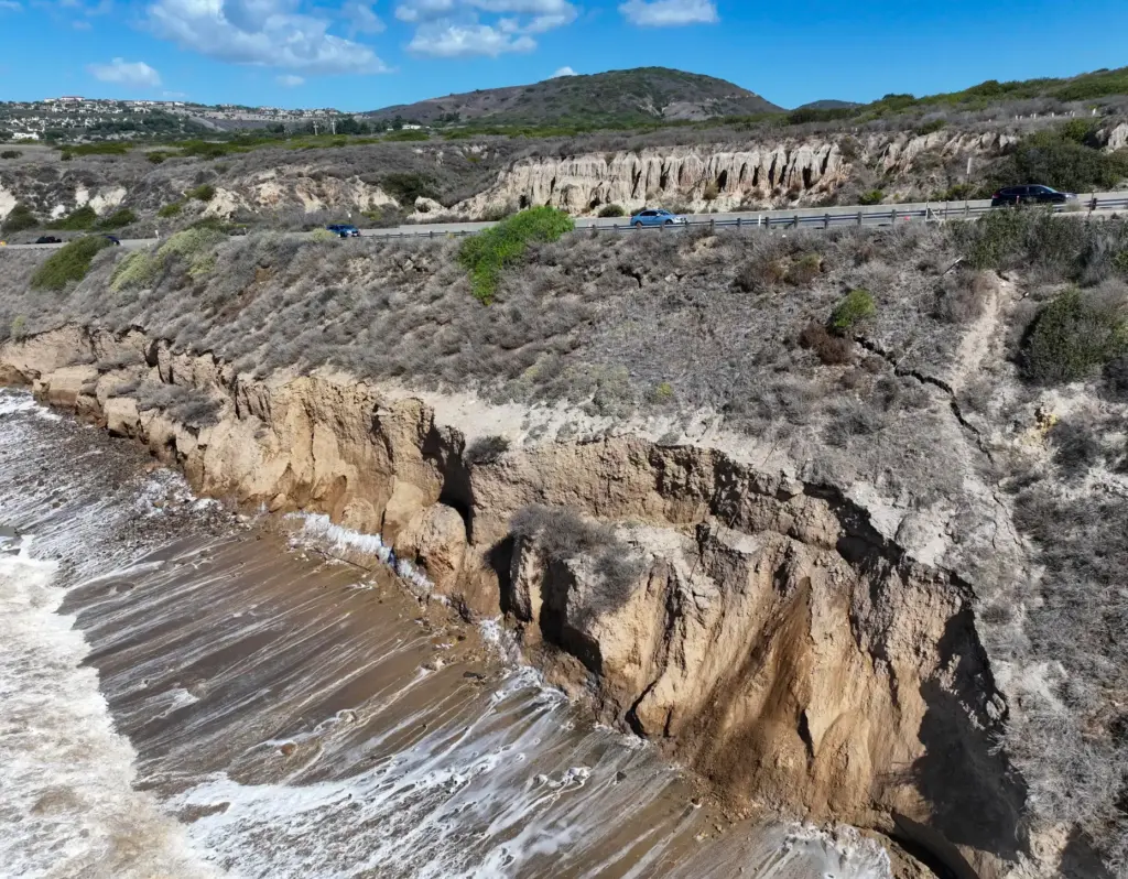 A lane of southbound traffic is shut down on Pacific Coast Highway as cracks appear in the crumbling bluff at Moro Beach at Crystal Cove State Park in Newport Beach on Tuesday, October 13, 2026. (Photo by Jeff Gritchen, Orange County Register/SCNG)
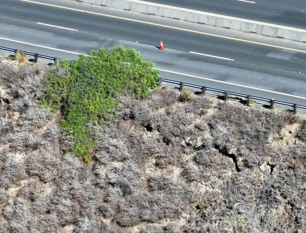 A lane of southbound traffic is shut down on Pacific Coast Highway as cracks appear in the crumbling bluff at Moro Beach at Crystal Cove State Park in Newport Beach on Tuesday, October 13, 2026. (Photo by Jeff Gritchen, Orange County Register/SCNG)
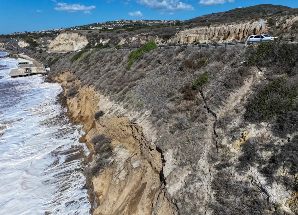 A lane of southbound traffic is shut down on Pacific Coast Highway as cracks appear in the crumbling bluff at Moro Beach at Crystal Cove State Park in Newport Beach on Tuesday, October 13, 2026. (Photo by Jeff Gritchen, Orange County Register/SCNG)
Caltrans has closed off the right lane of southbound PCH between Reef Point Drive and Irvine Cove Drive, Smith said. K-rail barriers are being relocated to the area and the lane closure will remain in place until repairs are complete, she said.
The repair method and anticipated duration of the lane closure have not yet been determined.
State Parks Superintendent Paul Andrus said the crack is near the area’s lifeguard headquarters and PCH is a main connector corridor.
“The highway that runs along there, there’s a bluff that goes down to the beach. That’s the concern; the erosion along the bluff could impact Coast Highway,” he said.
“It’s a significant amount of erosion,” Andrus said. “It definitely warrants their assessment and to have their engineers and geotech teams to evaluate it. We haven’t seen that level of erosion from previous storms in over a decade.”
Read more Employee arrested after listening device found in OpenAI conference room, FBI and the company say
Pro skimboarder Blair Conklin took video of the hillside crack along PCH, calling it “one of the most vulnerable pieces of California coast right now.”
“I bet you if nothing is done about it, this part of PCH will probably fall into the ocean,” he said in a video posted online. “I think PCH is bound to have some issues.”
His video shows brown ocean water, with Conklin noting that the murky water appears to be from the cliff eroding into the sea.
“I’m surprised there’s no cracks in the road yet,” he said. “Pretty insane … there’s a ton of dirt being lost and probably there’s about to be a big landslide right over there. Luckily, it doesn’t look like it’s under PCH yet, but it’s getting closer and closer.”
The area was already under review by Caltrans for an adaptation planning study that is assessing long-term planning for the stretchs of PCH along Crystal Cove and Bolsa Chica State Beach, also an area prone to flooding.
“These areas already experience periodic flooding and roadway closures, and future coastal hazards are expected to intensify these challenges,” Caltrans officials said in a statement when the study was announced.
The plan is to conduct an existing conditions and coastal hazard analysis this winter, with concepts presented next fall and a draft final study by summer 2027.
“The study focuses on understanding how conditions such as king tides, storms, wave overtopping, rising groundwater, tsunamis, and coastal erosion may affect safety, public access, transportation reliability,” officials said. “By evaluating these risks now, Caltrans can plan to keep PCH operating safely and resiliently for decades to come.”
The vulnerable area at Crystal Cove being studied spans 300 feet north of Moro Ridge Road to the Moro campgrounds.
A community survey launched Oct. 13 and will be open to the public through Nov. 6, with a virtual workshop planned for 6 p.m. on Oct. 21 with a presentation about climate resilience strategies. The public will be able to share input.
Read more Il Fornaio to pay $3 million to settle sexual harassment lawsuit
For more information: publicinput.com/pchcarp