
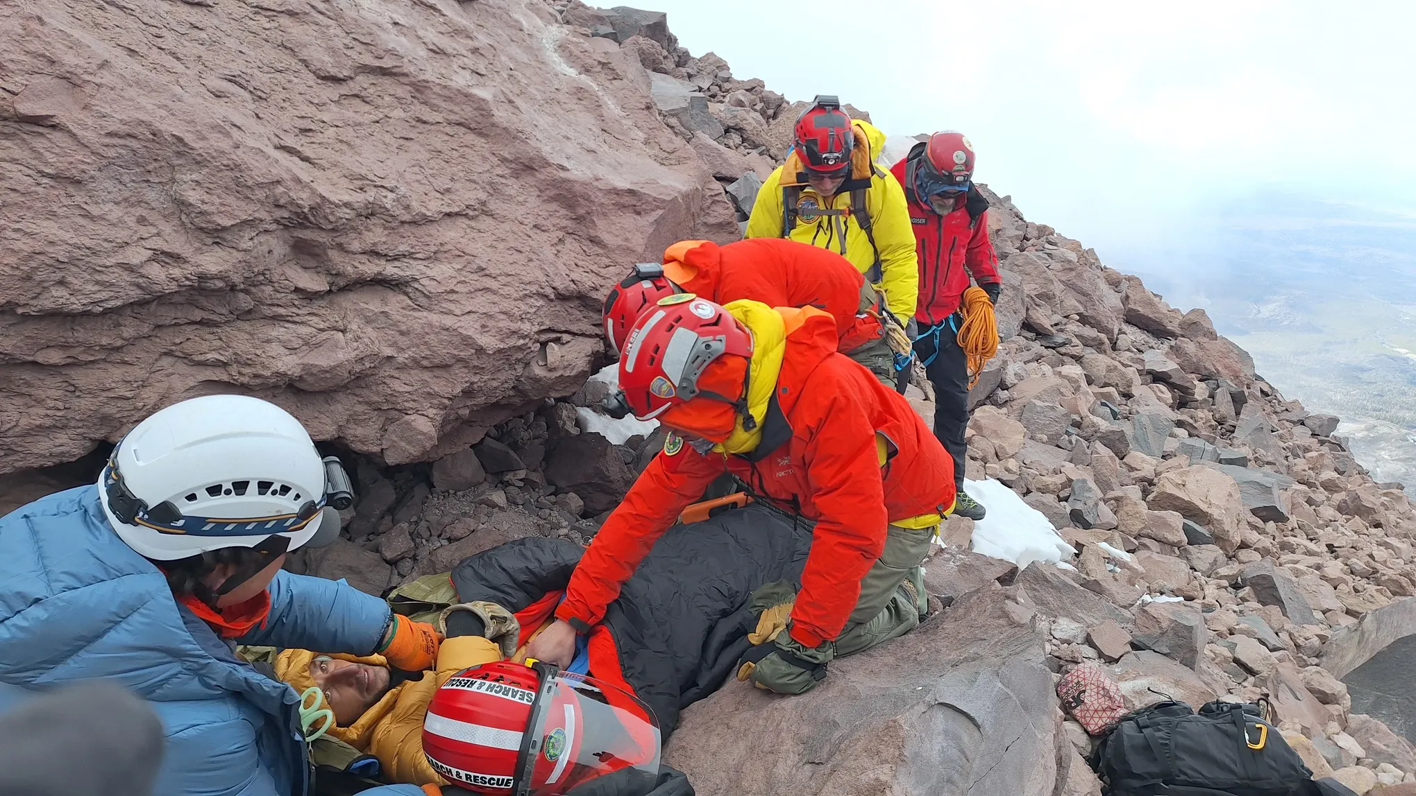
A climber became stranded for two nights on the coldest part of Mount Shasta after he followed his GPS device onto an unfamiliar route.
Read more UN climate fund promises $20 million for Nepal flood recovery, far short of billions needed
The man, who suffered a leg injury during the ordeal, was rescued Tuesday, Oct. 20, and airlifted to a hospital.
The report from Shasta-Trinity National Forest climbing rangers said the 39-year-old Florida man had made a solo ascent of the 14,179-foot peak, reaching the summit Sunday afternoon by the Avalanche Gulch route.
He later told his rescuers that his GPS navigation device advised him to descend by a different route, Whitney Glacier, on the northwest side of the mountain.
He carried trekking poles but did not have equipment for traveling on snow and ice, and he was wearing sweatpants and a hoodie, the rangers’ report said.
While descending the glacier, he stepped through a snow bridge concealing a crevasse and injured his leg. Unable to descend further, he made an emergency call.
Read more How close is the Amazon to a ‘tipping point?’ Brazil’s election could help shape its future
Because of the late hour and poor weather conditions, rescuers couldn’t reach him on Sunday, and the man had to spend the night at 12,100 feet elevation, on what the rangers said is the coldest part of the mountain.
The following day, the rescue became “complicated and difficult” because high winds prevented air rescue. Two climbing rangers reached the stranded man, bringing warmer clothing and moving him to a more protected area off the glacier. The three spent Monday night on the mountain.
The winds persisted on Tuesday. A team of volunteers from multiple agencies, climbed to the bivouac and used a litter to carry the man to the saddle between Mount Shasta and Shastina, about 11,890 feet elevation. A California Highway Patrol helicopter landed there and took him to a hospital for treatment of his leg injury and frostbite to a foot.
The rescuers descended on foot, concluding the operation late Tuesday. The team included volunteers from the San Mateo County and Marin County search-and-rescue teams and the Bay Area Mountain Rescue Unit.
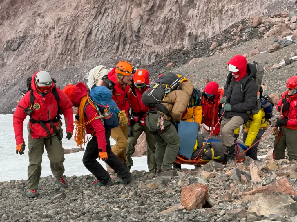 A team of volunteers from multiple agencies, climbed to the bivouac and used a litter to carry the man to the saddle between Mount Shasta and Shastina, about 11,890 feet elevation. (Marin County Sheriff’s Office)
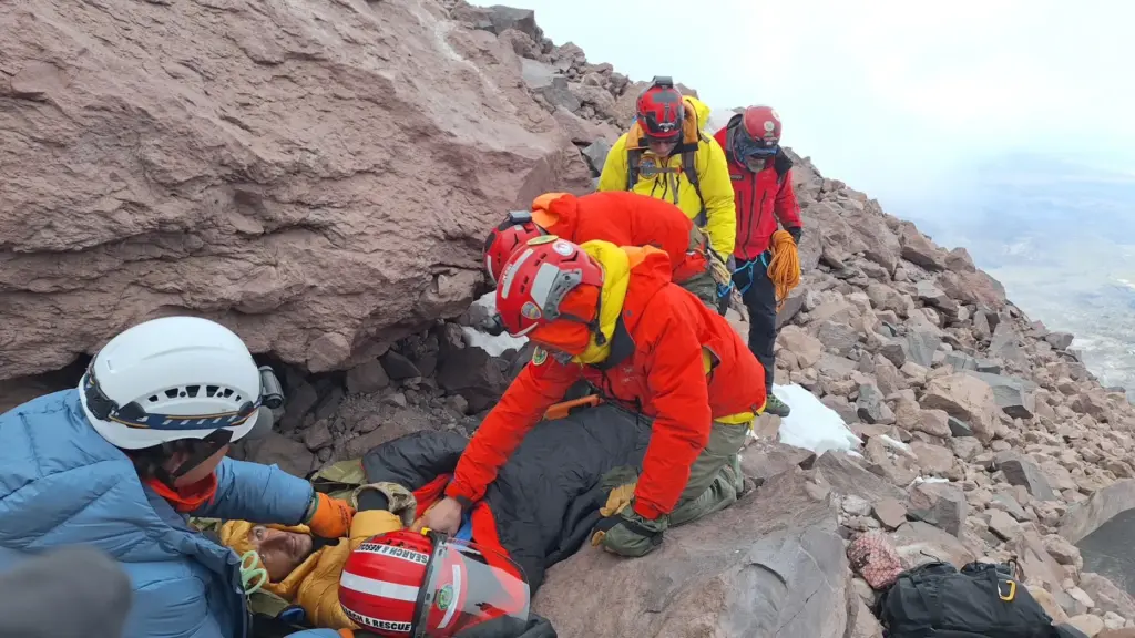 A team of volunteers from multiple agencies climbed to the bivouac and used a litter to carry the man to the saddle between Mount Shasta and Shastina, about 11,890 feet elevation. (Marin County Sheriff’s Office)
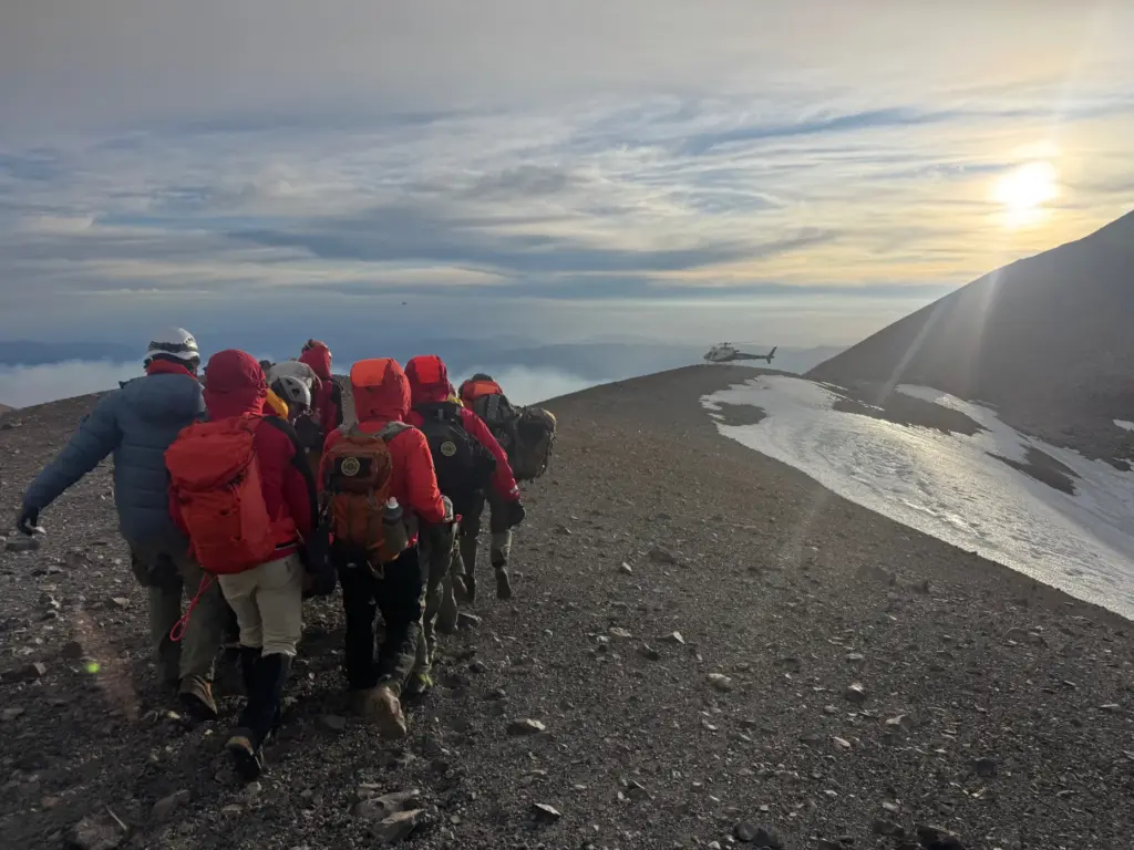 A team of volunteers from multiple agencies, climbed to the bivouac and used a litter to carry the man to the saddle between Mount Shasta and Shastina, about 11,890 feet elevation. A California Highway Patrol helicopter landed there and took him to a hospital for treatment of his leg injury and frostbite to a foot. (Marin County Sheriff’s Office)
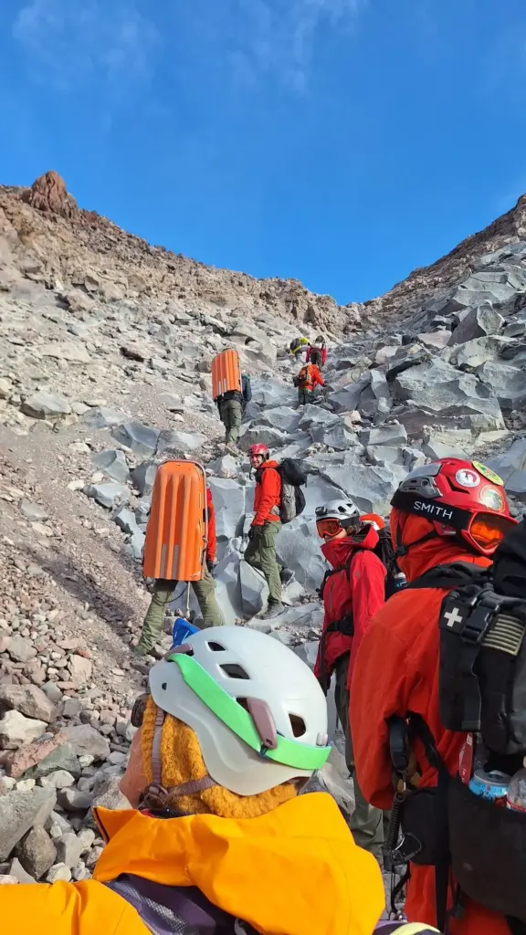 The report from Shasta-Trinity National Forest climbing rangers said the 39-year-old Florida man had made a solo ascent of the 14,179-foot peak, reaching the summit Sunday afternoon by the Avalanche Gulch route. (Marin County Sheriff / Marin Search and Rescue)
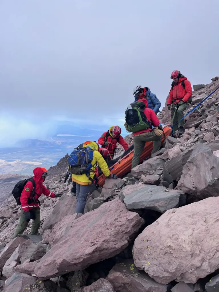 A team of volunteers from multiple agencies, climbed to the bivouac and used a litter to carry the man to the saddle between Mount Shasta and Shastina, about 11,890 feet elevation. (Marin County Sheriff’s Office)
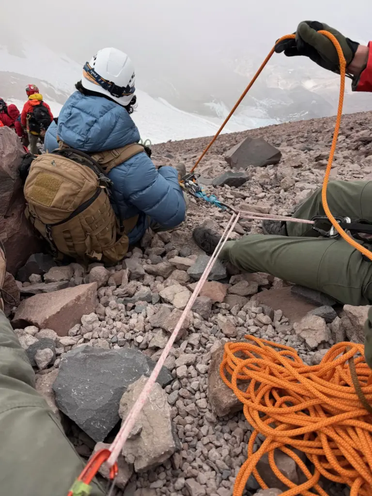 A team of volunteers from multiple agencies, climbed to the bivouac and used a litter to carry the man to the saddle between Mount Shasta and Shastina, about 11,890 feet elevation. (Marin County Sheriff’s Office)
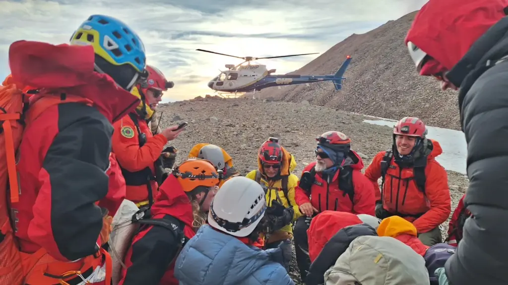 A team of volunteers from multiple agencies, climbed to the bivouac and used a litter to carry the man to the saddle between Mount Shasta and Shastina, about 11,890 feet elevation. A California Highway Patrol helicopter landed there and took him to a hospital for treatment of his leg injury and frostbite to a foot. (Marin County Sheriff’s Office)
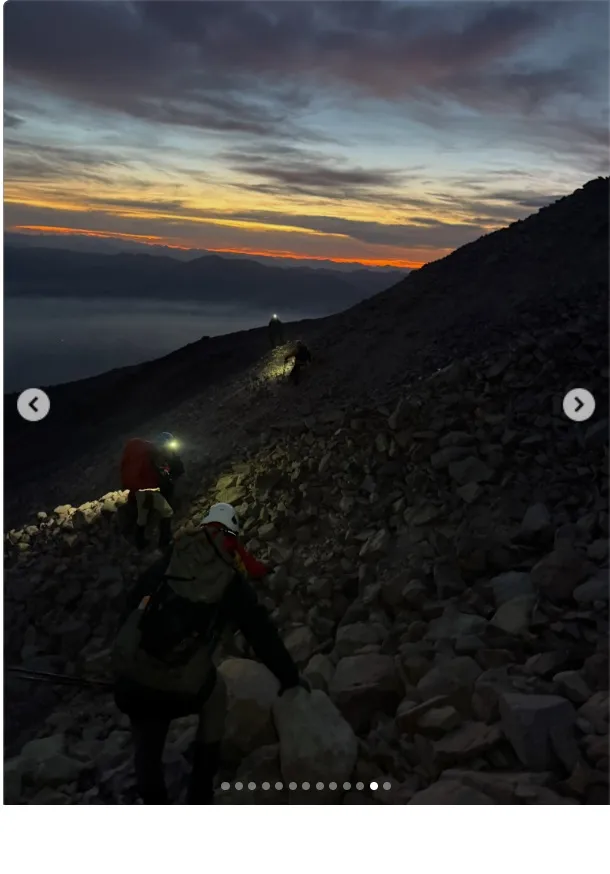 A climber became stranded for two nights on the coldest part of Mount Shasta after he followed his GPS device onto an unfamiliar route. The man, who suffered a leg injury during the ordeal, was rescued Tuesday, October 20th, and airlifted to a hospital. (Marin County Sheriff / Marin Search and Rescue)
Shasta, the fifth-highest peak in California, can be ascended by routes that don’t require technical climbing skills, but all are arduous treks. The Forest Service rangers don’t advise using the Avalanche Gulch route beyond the summer months, and they recommend a turnaround time of noon even if you haven’t reached the summit. More information on planning a Shasta climb can be found at the Mount Shasta Avalanche Center website.
Read more A Ukrainian soldier lost his sight in war. Now he hopes to see his children again