A cooling trend and increasing onshore winds are expected to help firefighters battling several Southern California wildfires this week, though forecasters warned that breezy conditions in inland and mountain areas could still create localized fire concerns.
Read more Man, 60, dies after fight with 2 teens at apartment complex near Angel Stadium
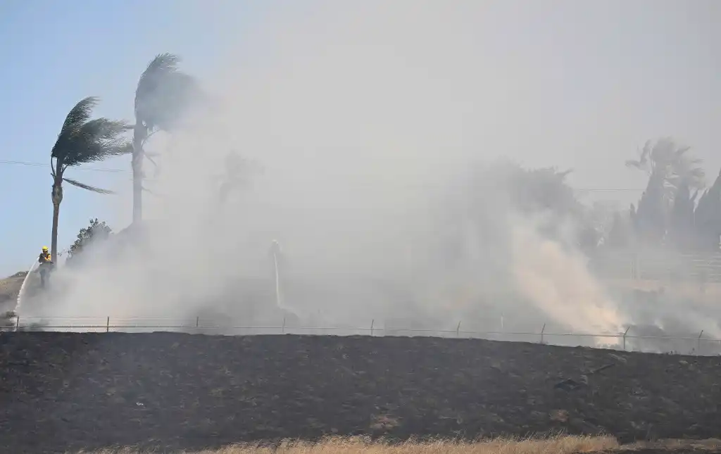
Fire crews on Wednesday, May 20, continued fighting the Sandy fire near Simi Valley in Ventura County, which had grown to nearly 1,700 acres and was 15% contained by Wednesday afternoon. In the Inland Empire, the Bain fire in Jurupa Valley had burned 1,375 acres and was 25% contained, while the Verona fire near Homeland had scorched 500 acres and was 5% contained, according to fire officials.
A weak area of low pressure moving across California will gradually deepen the marine layer, bringing cooler temperatures, higher humidity and increasing night and morning cloud cover through the weekend, according to the National Weather Service.
“Wednesday through the weekend there will be more westerly winds, which will bring in higher humidity and better fire conditions,” NWS meteorologist Adam Roser said.
In the Inland Empire, including Riverside and San Bernardino counties where the Bain and Verona fires are burning, temperatures are expected to remain warmer but gradually ease into the weekend.
Roser said inland areas could see highs in the mid-to-upper 80s through the end of the week before temperatures cool a few more degrees over the weekend and into next week.
Afternoon and evening west winds are expected to increase across inland valleys, mountains and passes, with gusts around 15 to 20 mph and breezier conditions possible at times.
In Los Angeles and Ventura counties, conditions are expected to become cooler and more humid through the weekend as onshore flow strengthens.
“Today is going to be the warmest day for the rest of the week,” NWS meteorologist Bryan Lewis said, adding that inland temperatures that reached around 90 degrees Wednesday are expected to drop into the mid-80s by the weekend.
Coastal and valley areas in Los Angeles and Ventura counties are expected to see increasing night and morning low clouds and fog, with temperatures cooling closer to seasonal averages.
Read more Shifting attitudes on menopause drive lawmakers to push for new protections
Lewis said the last few mornings brought breezy offshore winds, which can worsen fire behavior, but forecasters do not expect those conditions to continue in the coming days.
Instead, onshore winds are expected to increase each afternoon, helping cool temperatures and raise humidity levels across Los Angeles and Ventura counties.
“Offshore winds can ramp up fire activity,” Lewis said. “Onshore winds can too, but they also help bring cooler temperatures and higher humidity.”
Stronger afternoon and evening sea breezes are expected across the region, though widespread offshore wind events are not anticipated. Gusty west winds are expected in the Antelope Valley, while portions of Santa Barbara County could also see periodic north winds during the evenings.
Forecasters said the stronger onshore flow should improve firefighting conditions overall, though gusty winds and dry vegetation could still support fire spread in some areas.
Orange County is expected to see a steady cooling trend into next week as marine air pushes farther inland. Roser said temperatures should generally remain in the 70s through Friday before dropping into the 60s in many areas next week.
Coastal cloud cover and morning fog are also expected to become more widespread as the marine layer deepens.
Winds in Orange County are expected to remain lighter than inland areas, though afternoon and evening gusts of about 15 to 20 mph are still possible at times, according to Roser.